 Hardanger Shop
Hike
How long does Trolltunga take?
From Skjeggedal it is 27 kilometres and eight to twelve hours. From Mågelitopp it is 20 kilometres and seven to ten. The clock starts at the car park you actually get into, not on the rock.
Send this on hardanger.shop/guide/en/trolltunga
It is not an evening stroll from Odda.
- P3 Mågelitopp20 km7–10 hours
- P2 Skjeggedal27 km8–12 hours
- P1 Tyssedal38 km15 hours
Why it is graded very demanding
It is not an evening stroll from Odda. The official grades are easy, moderate, demanding and very demanding, and anything over 20 kilometres is very demanding on length alone. The path itself is solid and well marked. What takes the day is the distance, the height, and getting down before dark.
P3 Mågelitopp is the short start, and that car park should be booked ahead. A bus runs from Odda to Skjeggedal, and another between Skjeggedal and Mågelitopp. Timetables and parking change. Check trolltunga.com the day you drive, not an old post.
P1 from Tyssedal is 38 kilometres and 15 hours. That is a different hike from the one people mean when they ask how long the rock takes.
The day, from the road up
This is the official account of the day. Most people walk it in one, from P2 or P3.
From Skjeggedal the first stretch is not a trail. It is a narrow paved road up to Mågelitopp, 4.3 kilometres and 400 metres of climb, and it often takes more than an hour. Start at P3 and that hill is already behind you. Then the mountain path begins, about ten kilometres still to go.
At first it is fairly level, through a valley higher up, on a good path. After about three quarters of an hour the long pull up to Gryteskaret begins. That is the stretch people mean when they say the hike is hard, and the view opens as you climb. Another steep piece takes you up Trombeskaret and into a grassy valley where people camp. The path follows a small lake, then drops gently toward Store Floren. From there you look down on Ringedalsvatnet. It is the natural place to stop, and there is water in the streams nearby.
The name Store Floren says farmers kept animals on summer pasture here. The route is an old thoroughfare between west and east Norway, across the Hardangervidda. When the hydropower works at Tyssedal were built early in the 1900s, horses carried loads up this same route, and traces of the old stables are still there.
On the plateau, around 900 metres, the big climbs are behind you. The ground is still not flat. Snow can sit into late June in some years. The official page says the trail in 2026 may be clear of snow earlier than usual, and tells you to check Trolltunga Trail Information before you count on bare ground. Use the bridges over Endåen and the other riverbeds, including when they are dry. The plants up here are fragile, and the path is there so people do not make new ones.
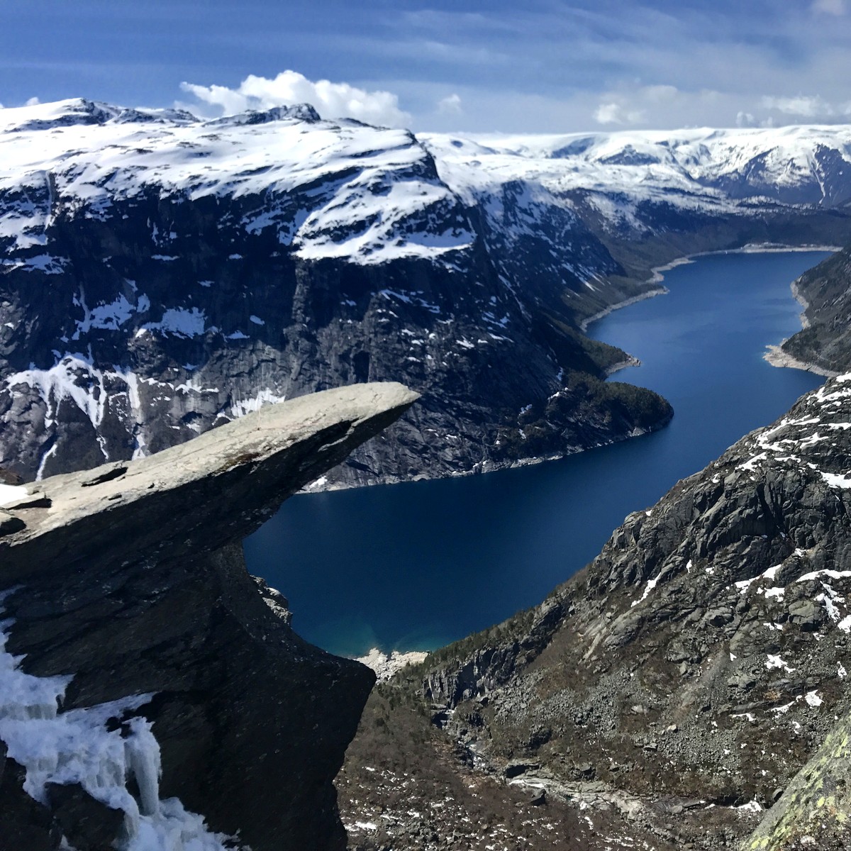
Then it climbs steeply again toward Endanuten. At Tyssehøl you cross a riverbed that once fed Tyssestrengene. That was a twin waterfall, 646 metres in all with a free fall of 312 metres, one of the great sights in the country in the nineteenth century. In 1967 the water was taken into the mountain for the Tysso II plant. Soon after, the path narrows. The drop beside you is high enough that you should watch your feet. Then the tongue is there, about 700 metres above the lake.
Four steps of iron rebar take you down onto the rock itself. Stay back from the edge. A fall from there is fatal. If you are alone, ask someone to take the photo and take theirs after. That is how the queue up there actually works.
The queue is lunch
The official site puts the change at about 800 visitors in 2010 and around 80,000 a year since. The crush is between 12:00 and 15:00, from about 20 June to 20 August, especially Saturdays and the first sunny day after several days of rain. On weekdays, allow 30–45 minutes to get out onto the tongue. On Saturdays it is often about an hour, sometimes longer. Early morning and later in the afternoon the queue is short. The path itself is wide enough that it rarely feels crowded while you are walking.
The wait is lunch. Eat. It passes faster than it does if you stand there watching the clock.
When you can go without a guide
Experienced hikers can go without a guide from 1 June to 30 September. For the rest of the year the advice is a guided hike. In 2026 that window closes on 30 September. Start early enough to be down before dark. The walk back takes less time than the walk up, but wet rock is slippery, and it is on the way down, tired, that people stop watching where they put their feet.
Do not go in strong wind, fog or heavy rain. The weather turns quickly, and it is colder and windier up there than by the fjord. Check the forecast the same morning.
The official page recommends that everyone on the hike is at least twelve, in good shape, and used to long days on foot. The mountain is no place for infants and small children. If you bring younger children anyway, plan to carry them the whole way, and stop often to see that they are warm.
What belongs in the pack
Wool next to the skin, an insulating layer over it, then a shell that stops wind and rain. Food and water for a full day, not for an afternoon. A headlamp, because dark will not wait for you at P2. Boots. Sunglasses and cream if there is still snow.
Three emergency shelters stand along the trail: Floren at Store Floren, Endåen and Tyssehøl. They are for storms and for trouble. They have sleeping bags, blankets and emergency rations. They are not the night you planned. If you are hurt, or it is serious: 112.
After the hike
Odda is the base. We have no physical shop in Odda, and we do not run the trail. What we make is printed to order and sent by post.


Sources
Checked 21 September 2026:
- The hike to Trolltunga on trolltunga.com — distance, time, grade, route, queue and season.
- Prepare for your hike — age, clothing, wind and rain.
The figures can change. The official page wins if anything here is out of date. The photograph at the top is ours, taken 15 May 2017.